Whitewater State Park
Before and After 360° Interactive Panoramas
Whitewater State Park in southeastern Minnesota experienced extensive flooding in August, 2007. I just happened to be there in June before the flood and captured a 360° interactive panorama of the Whitewater river. Going back almost exactly one year later I photographed a very different scene. Click on the images below for a first hand look. To view the interactive panoramas, you will need the Adobe Flash player. The panoramas are each about 1MB in size, and will launch in a new window.
Coyote Point Trail river crossing
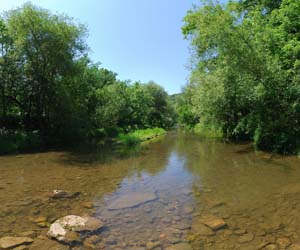
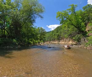
These photographs were take from the same location on the river crossing on the Coyote Point trail behind the nature center almost exactly 1 year apart.
| Before the flood | And a year later.. |
|---|---|
 |
 |
| Photo taken June 10, 2007. Click on the image to launch the panorama |
Photo taken June 21, 2008. Click on the image to launch the panorama |
More Post-Flood Images
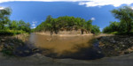
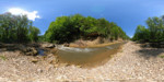
Here are two more post-flood panoramas from further upstream from the photo above. I don't have pre-flood photos from these vantage points. I've also included a panorama from the Coyote Point overlook, taken in June 2007. Click on the images to launch the interactive panorama viewer.
 |
 |
 |
| Post-flood, June 21, 2008. | Post-flood, June 21, 2008. | Coyote Point overlook, June 10, 2007. |
Other Links
- Whitewater State Park (DNR page)
- DNR Flood photo page
- Wikipedia.org page on Whitewater
- Information about these 360° interactive panoramas
All content Copyright © 2008 360 Degree Views